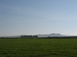
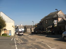
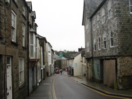
(1) Camelford
(2) Camelford
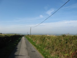
(3) Sign by Roughtor Road
Other Links >>> |
|
WATERMILL WALK
Circular walk from Camelford
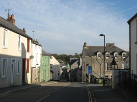
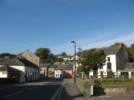
The Watermill Walk is a short circular walk in North Cornwall which I walked on Sunday 2nd October 2011. It took just 25 minutes to drive over from my mums' house to Camelford where I parked in the free car park just off Clease Road, close to the start of the village and opposite the Camelford Museum. From there I headed the few yards down Clease Road to the main road through Camelford which is where I joined up with the route of the walk.
|
|
|
|
(1) Camelford |
(2) Camelford |
(3) Sign by Roughtor Road |
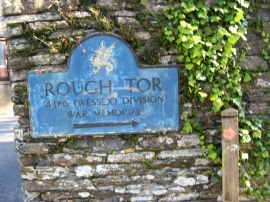
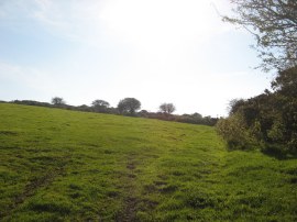
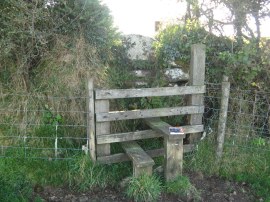
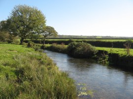
Turning to my left I headed down through the town, photos 1 and 2, crossing the small bridge over the river Camel, before heading uphill out of town alongside the A39. A short distance up the road the route heads down the first road on the right, Roughtor Road, which is signed posted with a blue plaque for Rough Tor, photo 3. Besides this is a wooden post with a white painted foot print symbol which is the way mark for this walk. The route heads along this narrow stretch of road and then continues ahead at a road junction to pass through the hamlet of Tregoodwell.
 |
 |
 |
(4) Wooden Footbridge |
(5) Heading up to the moors |
(6) Looking north towards Delabole |
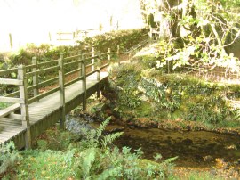
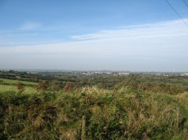
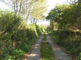
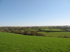
Leaving the houses the route heads downhill, crossing over a small stream before joining a track on the right hand side, one field up from the stream. The fallen autumn leaves rustled under foot as I headed along the broad tree lined track. Reaching a stile with stone steps besides a gate the route joins a path running along the bottom edge of a field which soon leads into a small wooded section of path with a stream running to the right of the path. The route then bends round to cross a footbridge over the stream, photo 4, before climbing over another stone stepped stile to join another field edge path. Here the path meanders through a few gorse bushes before heading uphill along a small a paddock and through a wooden gate and then along the left hand edge of a slightly larger, more open grassy field. Reaching the end of this field the route turns briefly to the left along a road before heading to the right along a driveway that's leads to Aldermoor Farm. Continuing past the farm buildings the route then heads along a farm track that leads out onto a set of moorland fields, photo 5. The route heads steadily uphill alongside the fields which views gradually opening up over the surrounding countryside, photo 6.
 |
 |
 |
(7) A Moorland Lane |
(8) The Moorgate Menhir |
(9) View towards Rough Tor |
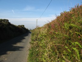
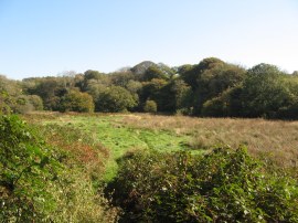
Reaching some farm buildings the Watermill Walk then heads to the right, making its way gently downhill along a narrow country lane, photo 7. The previous day had been the warmest ever October day in England and once again the weather was unseasonably warm. The temperature being was 21c when I arrived in Camelford with blue skies and hardly a breath of wind in the air making it feel much warmer than almost any summers day I had been out on this year. I had previously started to walk this route back in August 2010 although that day the weather had been absolutely appalling, very cold with torrential rain and low cloud blowing fast over the moor reducing the visibility to almost nothing. Back them when I reached this road I decided to abandon the walk and follow the road round as it began making its way back to Camelford, today the weather conditions could not have been more different.
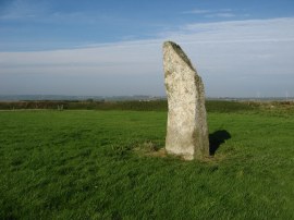
Leaving the road the route heads to the left along a footpath that runs along the edge of a big open grassy field that was being grazed by sheep when I went through. Towards the end of the field the route passes a longstone known as the Moorgate Menhir, photo 8, before turning to the left along a broad farm track heading to the left along the edge of the field. All around there were spectacular views, including ahead over to Brown Willy and Rough Tor rising above the heat haze, photo 9.
 |
 |
 |
(10) Another quiet moorland lane |
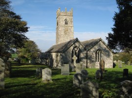
(11) St Adwenna's Church, Tresinney |
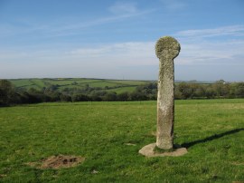
(12) Cross nr Tresinney |
At the end of the farm track the route crosses a stile by a gate and continues ahead along the right hand edge of a field. Reaching the next set of gates the route then bears to the right, heading diagonally to the right across a field. This path heads downhill to the far corner of the field before heading to the right, crossing a couple of stiles to join a path following running alongside the edge of another stream. This stretch of path is followed for a short distance down to a road where the route heads to the right. At this point the route had briefly linked up with the route of the moorland way which was represented by a green footprint sign on the wooden posts. As I was walking along the lane two buzzards glided silently low overhead which was a lovely sight to see, normally I only ever see them much higher up in the sky, not just a few feet above my head. Just before this lane, photo 10, reaches a junction the route joins a footpath on the right that heads downhill across fields towards a church, the spire of which can be seen ahead in the distance. The route heads diagonally across the first narrow field, over a stile which is rather hidden in the field edge, and then down the left along the edge of the next field. The route then continues downhill, passing to the right of a barn and over a couple more fields to reach St Adwenna's Church at Tresinney, photo 11, which is also known as Advent Church. Reaching the edge of the churchyard the route bears sharp left along an indistinct path across the field heading over a stile that leads down to a road, where there was an old metal footpath sign pointing to Advent Church. The route heads straight across this road and joins a path that heads across the middle of the field on the other side from where there were good views over the valley of the river Camel. This path is followed across the field towards a stone cross, photo 12, and then heads over another one of the wooden stile and stone step combinations that are used for many of the boundary crossings on this walk.
 |
 |
 |
(13) Field edge stile |
(14) Lane nr Trewint |
(15) Clapper Bridge |
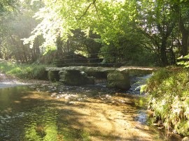
Crossing the stile, photo 13, the route curves round to the right before following a path running along the top of a field edge. This crosses over a fence and heads through the gateway on the left and then diagonally across the next field, the exit stile just above the first electricity pylon in the field. I missed this path at first, initially walking along the top edge of the field but soon realised I had gone off course and it did not take me long to spot the stile a little way below. Leaving this field the route bends to the right and heading across two more short sections of field joins another minor road where the Watermill Way heads downhill to the right. The route heads down this road, passing through a gate across the road, photo 14, to eventually reach a bridge over the river Camel with a ford and clapper bridge, photo 15, crossing a tributary a short distance before on the left.
 |
 |
 |
(16) The Old Mill |
(17) River Camel |
(18) View over to Tresinney |
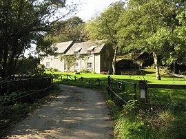
Crossing over the river Camel the route then heads steeply uphill along the road round an attractive old mill building, photo 16, before joining a footpath on the right that runs along the bottom edge of fields, a few yards above the river. This path more or less follows the river, photo 17, heading upstream, to reach another minor road. Here the route heads very briefly to the left before heading right along a footpath that heads up a driveway at Kenningstock Mill. This runs past one house and on to a second dwelling where the route turns sharp left, heading uphill round the back of a house before heading through a gate to join a field edge path on the right. This small section of path was rather confusing and could have done with a footpath arrow pointing to the left around the back of the house. At this point the path now running quite high up the side of the valley of the river Camel. The path heads along the bottom of three fields before crossing over a stile and bearing diagonally to the left across the middle of a large open field, with a rather run down barn with a curved roof at the top end, to reach a stile in the far corner. Looking away to my right there were excellent views back to Advent Church and the surrounding countryside that the outward leg of the walk had crossed, photo 18.
 |
 |
 |
(19) Approaching the River Camel |
(20) Walk Waymark |
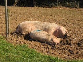
(21) Some rather hot pigs |
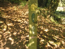
Crossing a rather steep stone stile the path headed across a rather overgrown section of verge before heading to the right along the B3266 road. This is followed for a short distance before the route leaves the road and joins a footpath that heads downhill along the right hand edge of a field. I had to have a brief stop here to put some sun cream on my arms which were beginning to get a little red, particularly around the elbows. Reaching the lowest point of the field the path heads through over a neat slate stile in the next field and a few yards further on then heads through a metal gate tucked away on the right. This leads to a tree lined path that heads downhill. Reaching the end of the short hill the route crosses an area of marshy ground, photo 19, down to the river Camel where, by a footbridge, the Watermill Walk links up for a short distance with both the Camelford Way and the Moorland Walk, each with thier own symbol on the wooden marked posts, photo 20. These two paths I hope to walk on a future trip down to Cornwall. Bodmin Moor is an area I always like walking, my grandparents once owned a farm on the moor where I spent many summer holidays as a child, and the scenery is very different from where I am currently doing most of my waking in the South East. The Watermill Walk does not cross the river by the wooden footbridge but instead heads sharp left, back across the marshy area of ground and away from river before joining a path that heads reasonably steeply uphill through the same area of trees I not long headed down through. This heads up to cross another slate stile before joining an enclosed path running along the edge of a couple of fields down to join a road. In one of these fields was a small pigsty and two very hot pigs lying stretched out in the sun, photo 21.
 |
(22) The end point of my walk |
Reaching the road the route heads straight across and up a driveway, soon bearing to the right and crossing through a metal gate into a field. The route then heads through a succession of small fields, passing through a number of old metal kissing gates. In the first of these fields I met a woman tending some horses who asked me if I had walked the path before and then warned me there were some cows in one of the fields ahead which I thought was a rather unusual comment and whilst I often encounter cows whilst out walking I didn't actually get to see these particular ones. This path is followed up to the houses on the outskirts of Camelford from where it was just a short walk down the A39 before I reached the junction with Clease Road, photo 22, which marked the end of this circular walk.
As usual I have uploaded the route of the walk which can be accessed here: Watermill Walk .
Reaching the car I had walked 7.83 miles of which probably about 7.7 had been along the path, allowing for the odd little bit where I had gone off course. I then drove home, had a quick bite to eat, and headed off for an afternoon in the sun at Porthcothan Beach. Although the route is has the odd way mark throughout its length, as pictured above, these are not really sufficient to follow the entire walk without the assistance of a map. It was however a very pleasant walk in a very nice part of the country made all the more memorable by the lovely weather.
 |
 |
 |
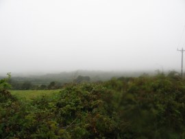
(23) Camelford |
(24) Looking north towards Delabole |
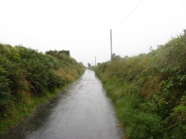
(25) A rather damp moorland lane |
If you would like to comment on this walk you can do so here:
![]() Back to:Walk index page
Back to:Walk index page
| ©2012 Bertuchi.co.uk. Please contact me using the email button on the right if you have any questions or comments regarding the site. Any feedback and additional information about places of interest on the walks is always welcomed. All rights reserved. Please contact me if you want to use any of the images or information from the site. ENJOY YOUR WALKING |
|